Download the full newsletter here.
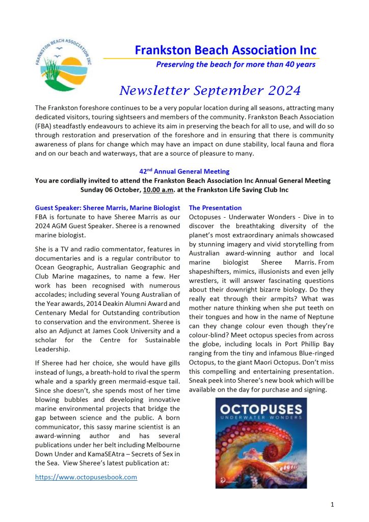
Download the full newsletter here.
Frankston Beach Association Inc. Managerial and Action Plan 2020/2021
The Frankston Beach Association (FBA) is a voluntary, not-for-profit incorporated organisation established in 1982. FBA works alongside Frankston City Council to safeguard the marine and coastal values of the municipality’s thirteen-kilometre-long stretch of coastline from Carrum to Mount Eliza. We work for the preservation and improvement of coastal foreshore assets and advocate for appropriate environmentally friendly uses of the beach.
Mission: Our aim is to be a valuable community stakeholder, active worker and advocator for the ongoing preservation and enhancement of the natural marine and coastal values of Frankston which are facing increased pressures from visitor numbers, watercraft use and pollutants.
About Us: Frankston’s coastline has its northern boundary at Keast Park, Seaford and it continues southwards to the mouth of Kackeraboite Creek, Mount Eliza. FBA focuses principally on the beach area between Olivers Hill and the Mile Bridge, while the Frankston Environment Friends Network (FEFN) and the Friends of Seaford Foreshore Reserve share a common interest in the foreshore reserve between the Mile Bridge and Keast Park.
The Frankston Beach Association was first established to champion the cause of the natural
coastal environment and its unique values in the face of a proposed large boat marina at the base of the iconic Olivers Hill, which posed a threat to the natural, historic, cultural and environment values of the beach. After extensive advocacy, inquiries and panel hearings, the marina proposal was discontinued. Ever since, FBA has been a key stakeholder working with relevant authorities and the community in balancing protection of natural coastal values with increasing demand for beach and bay uses.
In collaboration with Frankston City Council, FBA Inc seeks to protect and enhance the key values of Frankston’s coastal foreshore. The following strategic objectives guide our decision making and provide a broad direction for our active participation to conserve and protect biodiversity and ecological integrity:
Currently there are around 75 financial members of the FBA. New members are always welcome. A small group of around 12 members make up a committee of management which generally meets on the 3rd Tuesday of the month. An annual general meeting is held towards the end of each calendar year.
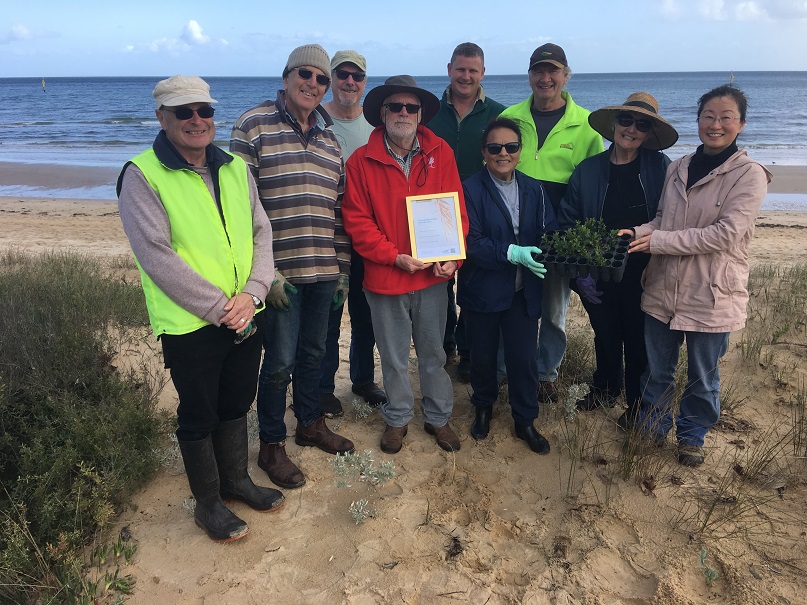
The annual membership fee is only $10 ($5 concession) and donations are very welcome. In recent years, FBA has been successful in obtaining grants which have primarily been used for foreshore revegetation with plants indigenous to the area and for removal of invasive and introduced weeds.
Frankston Beach Association is proud that our organisation, as well as a number of long-time individual members have received awards over the years in recognition of significant community contribution. As might be expected, there is a wealth of historic knowledge as well as current local knowledge of the bay, creeks and surrounding area.

Click this link to download a summary of Frankston Beach’s profiles: Frankston beach summary results Oct 2017 to May 2019

Neil Blake, Port Phillip Baykeeper has more than 30 years’ experience in protecting Port Phillip Bay.
As founding director of the EcoCentre, Neil Blake (OAM) has been widely recognised and loved by the community for his deep knowledge, personable character, and extensive experience in environmental management, local history, biodiversity and community development.
The Port Phillip Baykeeper program works with Schools, Government, Researchers, Business and Community to protect Port Phillip Bay. It is a community program of Port Phillip EcoCentre Inc and is affiliated with Waterkeeper Alliance, a global network of nongovernmental advocates for an identified waterway. Waterkeepers are recognised by their community and local government. They advocate compliance with environmental laws, respond to citizen complaints, identify problems which affect their waterway and devise appropriate solutions.
Summary of the KBR Report
At the risk of over simplification, a fair paraphrase of the report in every-day language would be as follows:

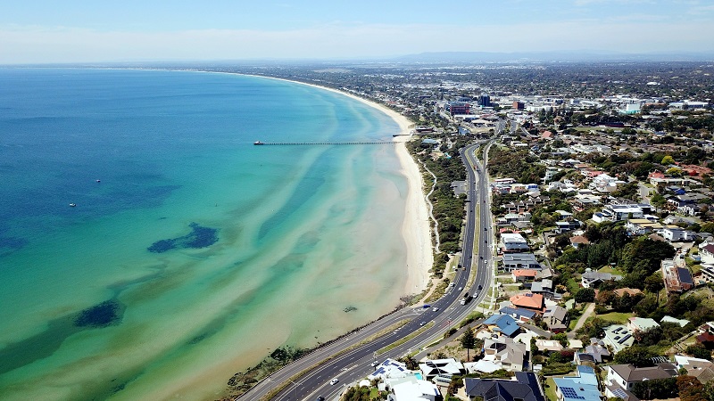
Frankston’s beautiful beaches attract over one million visitors a year for recreation, swimming and wellbeing. They are Frankston’s number one natural asset.
Please join with FBA-the 30 year protectors of Frankston’s beaches- in telling the CEO, Mayor and Councillors WE SAY NO TO THE BREAKWATER at least until proper coastal scientific and engineering processes and physical modelling data show unequivocally that Frankston beach environments will be unspoilt.
Please sign our petition here today.
For more information see https://www.frankstonbeachassociation.com or contact us on fbainc2006@hotmail.com .
Email to all Frankston Councillors councillors@frankston.vic.gov.au
Individual Councillors :
1. Mayor Cr Nathan Conroy Email: crconroy@frankston.vic.gov.au Phone: 0424 515 930
2. Deputy Mayor Cr Suzette Tayler Email: crtayler@frankston.vic.gov.au Ph: 0438 179 515
3. Cr Kris Bolam JP Email: crbolam@frankston.vic.gov.au Phone: 0417 921 644
4. Cr Steven Hughes Email: crshughes@frankston.vic.gov.au Phone: 0402 729 150
5. Cr Sue Baker Email: crbaker@frankston.vic.gov.au Phone: 0438 145 842
6. Cr David Asker Email: crasker@frankston.vic.gov.au Phone: 0438 175 560
7. Cr Brad Hill Email: crhill@frankston.vic.gov.au Phone: 0438 212 426
8. Cr Claire Harvey Email: crharvey@frankston.vic.gov.au Phone: 0438 267 778
9. Cr Liam Hughes Email: crlhughes@frankston.vic.gov.au Phone: 0434 703 239
State Member for Frankston
Paul Edbrooke MP Email:paul.edbrooke@parliament.vic.gov.au Phone: (03) 9783 9822
Federal Member for Dunkley
Peta Murphy MP Email: peta.murphy.mp@aph.gov.au Phone: (03) 9781 2333
Frankston Beach Association has been a strong advocate for our beach and precious foreshore environment for over 35 years.
The final outcome of this process including the Panel’s recommendation ‘to ensure that development along the Western and Southern boundaries of the Sub-precinct 1B responds to the sensitive interface with Kananook Creek and the surrounding foreshore and established residents area’, which is before Councillors tonight, will NOT celebrate a ‘sensitive interface’. The built concept has been pushed as far as it possibly can and shows no sign of sensitivity whatsoever. All our concerns and those of other community groups have fallen on deaf ears.
A series of 20 metre buildings with a few small wind tunnels on a beautiful coastal strip creates a dividing line/disconnection/blocking to the rest of the central business district and to the community at large.
FBA submits that Council should adopt the Planning Practice Note 60: the Victorian Government’s guide to the drafting of Structure Plans for Activity Centres, which clearly states that mandatory limits will be considered in exceptional circumstances which are identified as –
Precinct 1B fronts onto both of these environments.
Geelong is the only other designated Activity Centre with a coastal aspect. Obviously this Practice Note 60 is directed towards these two Activity Centres.
Geelong has observed this Practice Note and has introduced lower height levels overlooking its waterfront. It shows preferred building heights – Western Beach to be 9 metres and the inner Wedge precinct a preferred height of 20 metres.
Frankston’s Amendment C123 has ignored Practice Note 60. Why?
FBA recommends under 12 metres for a ‘sensitive’ interface’.
Furthermore, FBA recommends that Councillors, before approving C123, consider the Nightingale Projects – inner city housing developments built for growing populations, which adhere to the Nightingale pillars of social, environmental and financial sustainability. There are currently 12 projects in active development. The Nightingale Project is a visionary concept which delivers multi-residential housing in cities which is environmentally sustainable, financially affordable and socially inclusive and which promotes better health and wellbeing outcomes for residents.
Let us also be visionary. Thank you for your attention.
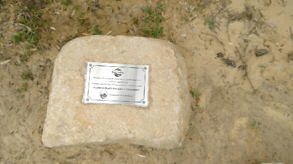
Please go and see our recently installed plaque. It’s a few metres in from the south end of the boardwalk, under some Banksias and looks great!
The following is a summary of FBA’s latest submission on the proposed Coastguard building, safe refuge and breakwater at Olivers Hill, presented at Council Meeting 3rd September 2017.
The community was given 3 days to prepare a submission on the above developments in the Council’s Agenda.
FBA support the volunteer Coastguard and its endeavour to save lives, however, as a Council representing its community we expect some sort of compromise between coastguard service and the preservation of Frankston’s most popular swimming beach – the beach and the foreshore is our greatest asset.
There has been no compromise. The Coastguard Executive Summary Risk Mitigation acknowledged by Council, in its Agenda, states that the key risks relate to understanding “the impact of the breakwater on the coastline and sand movements.”
Council is taking no action to mitigate these risks; this is a major gap and raises questions about the focus and management of the planning and approval process.
Council in consultation with the Coastguard over a 12 month period has ignored the key risks. There is no evidence other options were considered. The rationale provided for the relocation is:
FBA submits that the Coastguard and FCC ought to seek options in support of the Coastguard which will not interfere with coastal processes by using its current location – demolishing and rebuilding and mooring the large rescue boat on the lee side of Frankston pier, thus providing a quick response to emergencies. There is also the vacant information centre available.
These options give the Coastguard a more visible community presence and an opportunity to engage with the Yacht Club rescue activities and with people who are using the Bay.
Historically, all government and private investigations that have been completed at Olivers Hill have insisted that anything to do with coastal processes and structures going out into the Bay must include numerical and physical modelling and the Council and the Minister for Planning has agreed with this through Amendments to the Frankston Planning Scheme –
1999 Panel Report, and the 2003 Minister’s Assessment, C15;
2004 C30 Amendment;
2008 Priority Development Panel Report and the 2009 Planning Scheme Amendment, C50.
FBA’s experience with the history of similar structures in Port Phillip Bay and failure to predict the effects of breakwaters, highlights the need to ensure sand movement is understood and addressed in particular to the north of the proposal; effectively, numerical and more importantly physical modelling.
All the information FBA holds regarding the development proposed at Olivers Hill is the Council’s Agenda 3rd September 2017 and a Scope statement 20th October 2017. Both of these are inadequate:
The Council’s Agenda 3rd September 2017 documents Federal Government funding $500,000 (which has not been signed off), hydrological plans, concept plans, staged development of a new coastguard building and safe haven at Olivers Hill, but lacks funding for physical and numerical modeling, which should take place prior to the above development.
It is of great concern that despite the ‘key risk’ being identified as ‘understanding the impact of the breakwater on the coastline and sand movements,’ there is no action to quantify what will occur.
Council in the Agenda states indicative costs:
“$145,000 for a Hydrological Study and concept design of breakwater (utilising part of the %500K Federal Government grant currently awaiting approval);
$15,000 for a Geotechnical Report for new building location;
$14,000 for a Concept design for new building.
The anticipated total project cost of the relocation of the building carpark and landscaping….is in the order of $.5M. In addition, the total cost of the breakwater is estimated to be …$3M.”
Council also recommended “wholesale reconstruction of existing HQ.”
Gillian Kay, Frankston Council’s Director Community Development, 20 October 2017 emailed the following scope to community members who attended a meeting 18th October 2017 –
“The project is for the development of plans through hydrographic surveys and modelling and part construction of a breakwater in front of the Oliver’s Hill foreshore boat ramp. The breakwater is envisaged to be constructed as a rock wall with a road on top for emergency vehicle access and includes lighting and CCTV. It will provide safe refuge for small recreation craft and police boats in heavy weather and a secure permanent mooring in 2 – 3 metres depth for the Frankston Volunteer Coast Guard rescue vessel. It will also enable all weather launching facilities for recreational vessels in the southern region of Port Phillip and include pedestrian access for visitors with views across Port Phillip Bay. Pedestrian access will also allow for fishing, diving and other activities off the breakwater.
The above scope provides sufficient information for the experts to collect data and undertake modelling of conditions that will inform the development of concept plans.” Gillian Kay.
What is of great concern for FBA and the community is that the coastguard proposal will require a very large road going out to sea in 2-3 metres of water without, we believe, giving consideration of the effect this large dense structure will have on the sediment (sand) movement and the loss of our sandy beaches.
FBA sought advice as follows:
Comment provided in response to the project scope by a geomorphologist states:
“I would be very worried by the vagueness of the Scope as stated by Gillian Kay.
It states ‘… development of plans through hydrographic surveys and modelling … ‘ ‘Hydrography’ by all definitions (geological and dictionary) means ‘the science that deals with the physical aspects of waters on the earth’s surface, esp. the compilation of navigational charts of bodies of water’. It does not refer specifically to the effects and impacts of moving water on sediment or other features (natural or otherwise) of a coast. An important matter for any survey would be the impact of a solid barrier structure on sand movement, erosion etc., especially a barrier long enough to get into deep water (2–3 m is mentioned). That requires study by a coastal geomorphologist who has had experience in such structures — the Victorian coast has had numerous cases where structures have produced adverse results, especially with sand depletion or accumulation in the ‘wrong’ places. The average engineer does not have this expertise.
It then mentions modelling. What sort of modelling? Again, it takes a coastal specialist to do this properly. Is it expected that the survey will investigate previous studies that have been done in this situation, or others that can be regarded as comparable (which depends on all sorts of factors such as orientation, weather patterns, seasonal changes, tidal ranges etc.).
I disagree with Gillian Kay’s statement: The above scope provides sufficient information for the experts to collect data and undertake modelling of conditions that will inform the development of concept plans. It gives no indication of the potential issues that would need to be addressed, and the level of investigation that would be required.
I would also be concerned that it refers to ‘part construction of a breakwater’. It would be quite inappropriate to start a construction without a final plan based on thorough preliminary investigation.”
The project, with the support of the Councillors, risks destroying an unspoiled natural environment used by 1000’s of people. FCC does not have the understanding of coastal processes and it appears it has no intention of carrying out coastal modelling, PRIOR to the other studies it proposes.
Numerical and physical modelling is estimated to cost under $500K. Compare this with the cost of the proposed development and the impact on our foreshore and beaches.
FBA took Leon’s advice and enquired whether KRB (the engineering company Council has commissioned) a geomorphologist on its team –
We confirmed the following:
KBR has a Coastal Geomorphologist within their team who can be consulted as required to ensure they have a good understanding of both water based and land based coastal processes. The report council is intending to engage KBR for will include reviewing reports done by other consultants and state government departments over previous years as well as undertaking their own analysis on historical and current conditions of the shoreline, dunes and vegetation. Combining historical and current land and water data with the latest hydrographic modelling this will inform their component of the report which will assess what effect the installation of a breakwater is likely to have on the hydrography, beaches and dune systems along Frankston’s coastline.
This statement appears to be ambiguous in the sense that consulting the geomorphologist will be a minor study – the Hydrological study is the primary area; it is not a littoral process associated with sand movement arising from effects of currents, waves and tides and in particular in the context of changing climate conditions.
In view of the risks to our beaches and foreshore, FBA approached Neil Blake, the Baykeeper, regarding the large breakwater and boat refuge at Olivers Hill. Neil offered to join with FBA and conduct a numerical exercise to develop a profile method for monitoring change in beach and intertidal sand surface that records the surface level of sand across Frankston beach and intertidal zone over 12 months in 4 quarterly sessions
This study was developed with a geomorphologist from the University of Melbourne. We commenced our profiling on 21st October 2017 and will continue quarterly Neil has already completed 12 monthly profiling of McCrae and Middle Park beaches and this will continue for another 12 months. The minimum for collecting data for numerical modelling is 12 months.
Another aspect to be considered is the advice of Captain Frank Hart, Master Mariner regarding the planned location of the safe refuge, which will be exposed to the dominant onshore winds. There is no shelter available near-by. If yachts, small boats are unable to enter the boat harbour in strong onshore winds there is no suitable alternatives – in all designs to date the problems of a dangerous lee shore have not been recognised and have been ignored.
In view of all the above facts, to call the planned harbour a safe refuge is misleading and inaccurate in adverse weather conditions. In such conditions Olivers Hill because of its exposed location, is a place where a skipper should think long and hard before choosing to lose sea room and head towards the harbour to seek refuge.
Under such conditions, Frankston will be attracting boats at sea into a dangerous situation.
Finally, Frankston Council needs to understand the risks to their major recreational activity area in Frankston and steadfastly protect it. The long sweep of shoreline from Olivers Hill through to Seaford is unparalleled as a natural beachscape and should not be destroyed through inadequate planning processes.
Frankston ratepayers will not thank Council if it burdens them with remedial works in perpetuity.
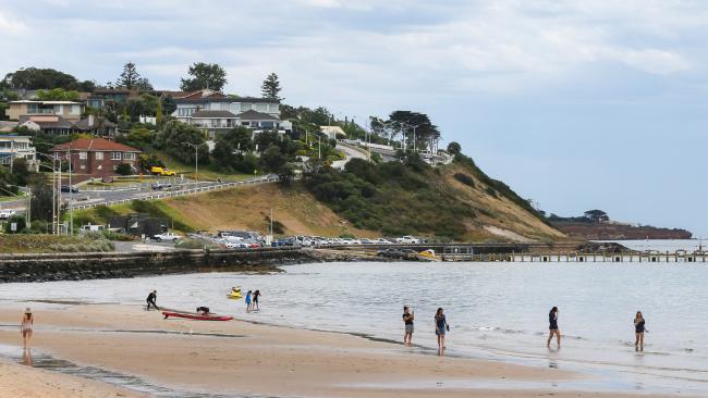
Image via Herald Sun.
In this submission, Frankston Beach Association (FBA) wishes to comment and respond on Precinct 1B between Nepean Highway, the beach and Kananook Creek.
Our beautiful coastline is our greatest asset and we believe that the Guidelines do not consider the waterfront character; what they facilitate is a super urbanised concept superimposed on a seaside municipality.
When reflecting on the status of Frankston as an Activity Centre these Guidelines should follow Geelong’s example and reduce heights to lower levels and provide sufficient setbacks; 32 metres is not a sensitive response to a coastal or creek environment.
Geelong, which is the only other designated Activity Centre with a coastal aspect has complied with Planning Note 60, the Victorian Government’s guide to the drafting of Structure Plans for Activity Centres. To its disadvantage Frankston has ignored Planning Note 60 and has produced Guidelines that don’t enhance and promote a seaside town; for example
Schedule 1 to the Geelong Activity Centre Zone states –
Schedule 17 to the design and development overlay –
FMAC Guidelines should clearly and explicitly support a strong direction to respect the Frankston waterfront character and avoid dominating the waterfront through excessive bulk and unarticulated built form.
We wish to comment on specific items in the Guidelines as follows –
2.3 Sensitive Interfaces – we support the provision of a network of streets, lanes and pedestrian paths from the city centre, along the creek and coastal interface. Plant species should be indigenous.
2.6 Built form with the Activity Centre – we support good city streets allowing people to use them in all kinds of weather, providing shade and shelter.
2.9 Responsive to Frankston’s Role as a Metropolitan Activity Centre-– as a seaside Activity Centre we have a responsibility to have more than an urban, metropolitan focus. Frankston’s vision should be to sensitively integrate the seaside aspect as much as possible. The seaside is what makes Frankston unique and is a great advantage over other Metropolitan Activity Centres. It will draw people to live, play, and shop in a great environment.
3.1 Active and Engaging Frontages – we support the five actions, however, the actions must always celebrate the seaside aspect. Specifically, the number 5 action to integrate Indigenous species is essential.
3.2 Sensible Interface Area – We support the design of Podium separation and the setbacks; in principle, but not the design in the Guidelines. The design image gives the illusion of separation but the visually dominant, high building form, with minimum separation, blocks visual access to the beach. Mandatory height limits are required. The Planning Practice Note 60 clearly states that mandatory limits will only be considered in exceptional circumstances which are identified as –
Precinct 1B fronts onto both these types of environments. Please remove 32 metres height from 3.2. FBA strongly objects to 32 metre height, it is far too high – on entering Frankston, the seaside is not visible from Nepean Highway and there is no invitation to explore the coast.
3.4 Maintain neighbourhood character –
Council’s guidelines for buildings along sensitive interfaces are not clear language statements eg what does “their adjacencies to lower scale development and natural environment” mean?
Diagrams are “sketchy” and difficult to interpret particularly for 3.4 nwhere they appear to convey that height makes no difference to solar access.
3.6 Sense of Enclosures – 1:2 and 1:3 are not ideal traditional main streets – they are busy urban streets with congested traffic, uncomfortable pedestrian spaces and not easily transplanted to Frankston. The Guidelines could find better examples eg on the Peninsula better examples are the main streets in Mornington and Mt Eliza.
The Illustrative Guidelines do not give convincing alternatives to achieve Precinct Guideline 5.1.4
We also wish to draw attention to the current problem of wind tunnels in both eat/west and north/south running streets. We recommend that this problem is addressed in any future planning and building design.
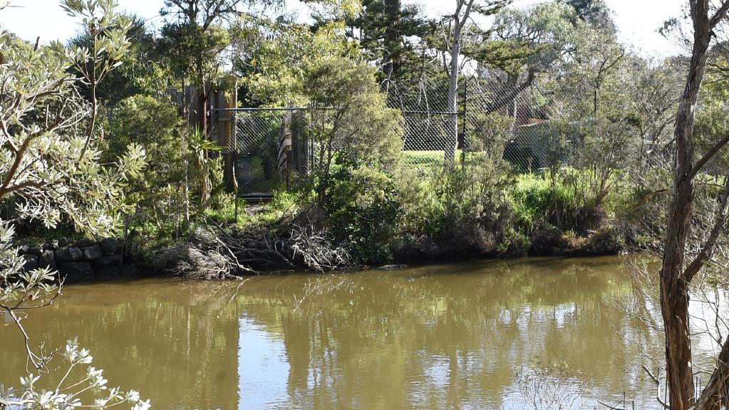
We also feel there is not enough linkage between Kananook Creek and the Coast. As the creek runs behind the sand dunes, it should be treated as part of the coastline.
We trust our comments will be respected.
Image source: Herald Sun